
Description
02
Intro
Ascherhütte – Medrig – Furglertal – Bergli – Stielalpe – Flath – Gamperthun Alpe – Grübele See – Rotwegkapelle – Kappl
Description
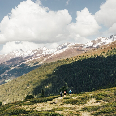
From Ascher Hütte lodge, follow the mountain lodge trail via Medrig to Gratli, where the marked
footpath starts. At the next fork in the trail, continue along the lower trail, which grants you
breathtaking views as far as the Istalanz valley and Berglialpe. Follow the trail through the
Furgler valley until you reach a wayside cross. From there, continue towards Masnerjoch. The
trail now runs above Berglis Wall (also known as the Black Wall) into the Bergli, and is relatively
exposed. From the wayside cross at Bergli, the trail continues downhill until you reach a fork.
Follow the uphill trail until you reach the remote but magnificent Stielalpe at 2,050 metres
above sea level.
From there, continue along the mountainside further into the Flath valley, where the last ascent
of the day up to Alpe Gamperthun at 2,070 metres above sea level is waiting for you. The mountain
lodge there is open for business and a perfect spot for a well-deserved break. Afterwards,
follow the trail to the exposed chapel, further into Grübele valley and up towards the “outer”
mountain lodge. Alternatively, continue a little longer until you reach picturesque Lake Grübelesee.
About 500 metres after the outer mountain hut, the footpath branches off down to the
valley, with a wooden bridge leading across Grübelebach creek.
From there, continue your way down into the valley along the forest road and towards the
Panoramic Trail. Via a fork in the trail, you get back to the forest trail that takes you past Rotwegkapelle
chapel and back to Kappl.
Arrival
Parking
Public transport
With the railway station in Landeck, the Paznaun is optimally connected to the Austrian train network. From Landeck-Zams station, only a short bus ride separates you from the Paznaun. Every half hour, line bus 260 runs from there through the valley.
Bus stop: See Dorf/ Bergbahn
Buses in the Paznaun valley | Region Paznaun – Ischgl
Tour type


